Captain Segull Fishing Charts has been a trusted name in saltwater fishing for more than 30 years, providing anglers with comprehensive, easy-to-use fishing charts that cover waters from Maine all the way to Texas. Built on decades of experience and a genuine passion for fishing, Captain Segull Fishing Charts was created with one simple goal in mind: helping people catch more fish. Whether someone is a first-time fisherman preparing for a family outing or an experienced offshore angler searching for productive fishing locations, our charts are designed to provide valuable information that makes every trip more successful and enjoyable. Our family has always loved fishing, and through years spent on the water we understood that many fishermen struggled with finding reliable information presented in a way that was practical and easy to use. We wanted to create charts that simplify the process of locating productive fishing areas while providing the level of detail serious fishermen demand. Today, Captain Segull Fishing Charts continues that mission by offering some of the most complete and detailed saltwater fishing information available anywhere.
Planning a successful fishing trip begins long before the boat leaves the dock. One of the biggest challenges anglers face is deciding where to fish and understanding which areas are likely to produce results. Too often, fishermen spend valuable time and fuel searching for fish rather than fishing for them. Captain Segull Fishing Charts help solve that problem by clearly identifying productive fishing areas and displaying them in an easy-to-read format. Our charts provide anglers with a broad overview of their selected region, allowing them to quickly identify locations, understand the layout of the area, and make informed decisions before ever stepping onto the water. This larger perspective helps simplify trip planning and eliminates much of the guesswork that can make fishing frustrating. Rather than spending hours researching multiple sources or relying on limited information, fishermen can look at one chart and immediately understand where they should begin their search.
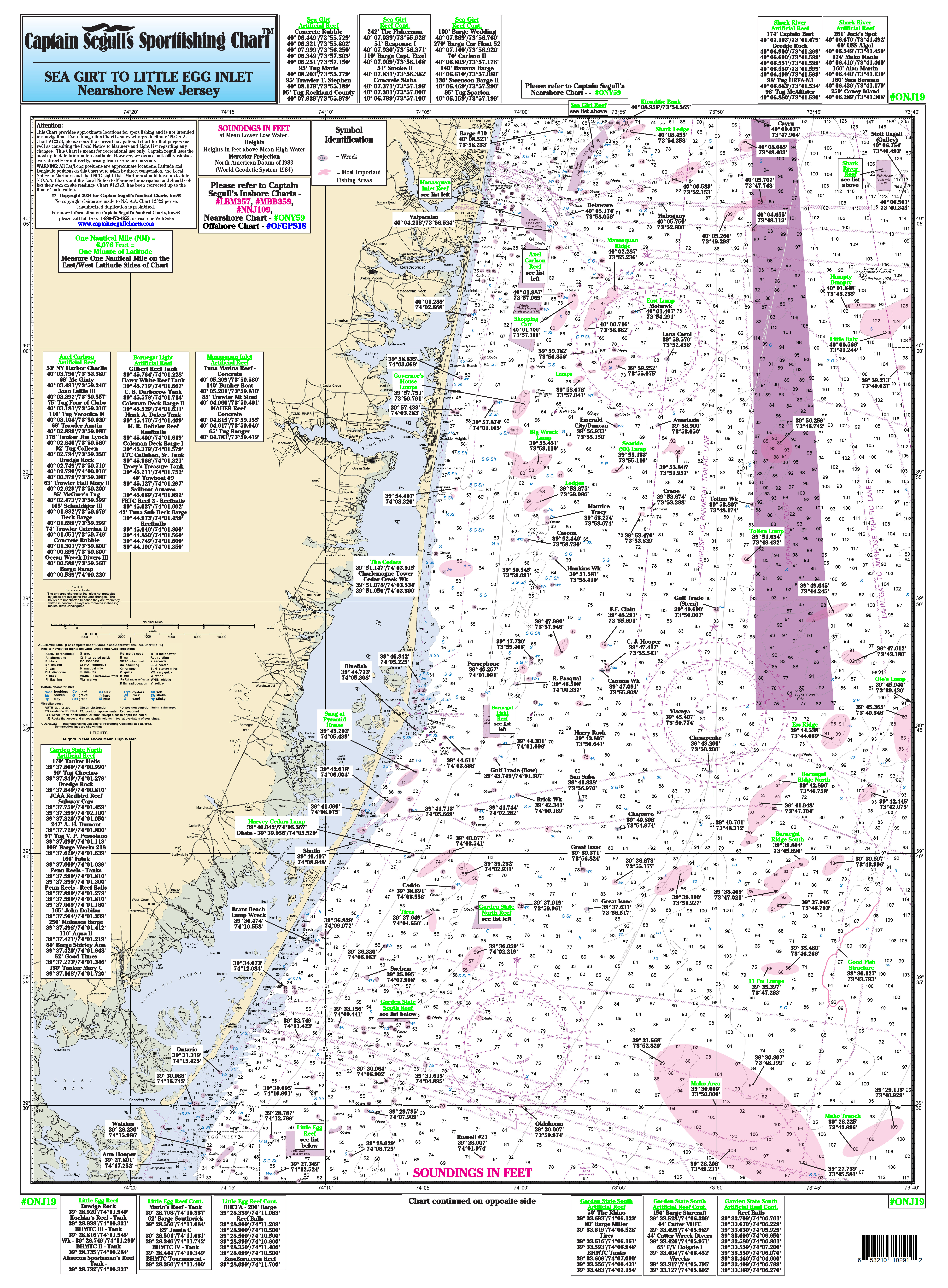
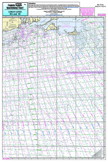
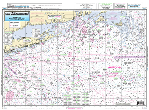
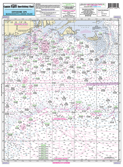
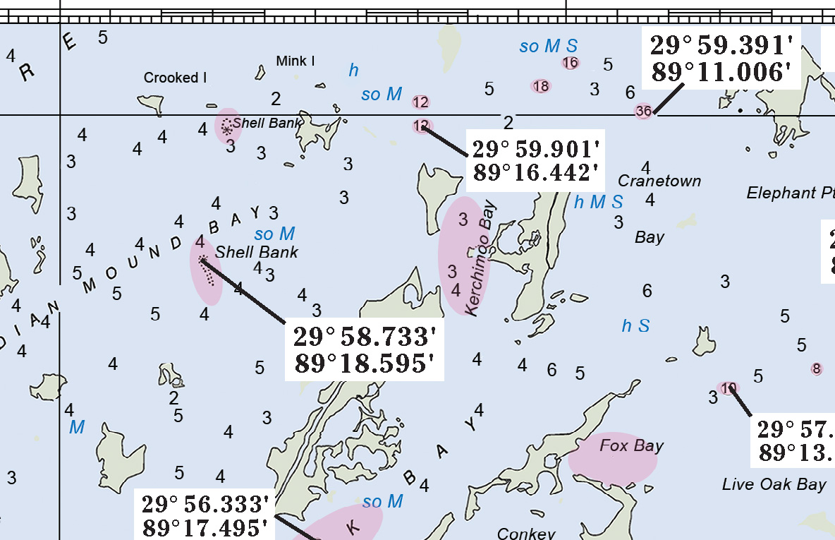
What makes Captain Segull Fishing Charts stand out is the incredible amount of detailed information packed into each chart. We provide more GPS coordinates than many GPS units themselves and include a larger number of fishing locations than many competing products on the market. Our charts contain extensive information on wrecks, reefs, ledges, contour lines, and local fishing spots that have become known and respected by area fishermen over the years. Many locations include local names, giving anglers access to information often known only within regional fishing communities. These are not generic charts filled with broad approximations. Instead, they are highly detailed resources designed to help fishermen locate the exact structures and underwater features where fish are most likely to gather.
Fish naturally relate to underwater structure, and understanding where these structures exist can significantly improve fishing success. Reefs provide habitat for many species and attract baitfish that larger game fish feed upon. Wrecks often become underwater ecosystems filled with marine life. Ledges and drop-offs create changes in current and depth that attract feeding fish. Contour lines help fishermen understand underwater topography and identify areas where fish are likely to concentrate. Captain Segull Fishing Charts bring all of these important elements together in one easy-to-use resource. By having this information available, anglers gain a much clearer understanding of where fish live, feed, and move throughout the day.
Our commitment to accuracy and usefulness goes beyond simply creating charts and leaving them unchanged. Fishing conditions, productive locations, and local knowledge continue to evolve over time, and Captain Segull Fishing Charts are constantly updated with information gathered from local fishermen and ongoing research. We recognize that some of the most valuable information comes directly from people who spend countless hours on the water. By working closely with experienced local anglers and incorporating their knowledge into our charts, we can continue to provide current and practical information that benefits fishermen everywhere. This continuous updating process helps ensure that our customers have access to reliable and relevant information rather than outdated data that may no longer reflect current fishing conditions.
Another major advantage of Captain Segull Fishing Charts is the convenience they provide while actually out on the water. Conditions can change quickly during a fishing trip. Perhaps you arrive at your first location and find that the fish simply are not biting. Maybe weather conditions shift and require a change of plans. Sometimes fishermen hear reports over the marine radio that fish are actively feeding in another area nearby. In situations like these, having a Captain Segull Fishing Chart onboard becomes extremely valuable. Instead of wasting time trying to search through electronic menus or guessing where to go next, anglers can quickly reference the chart and immediately identify nearby fishing locations. Having a clear visual reference allows for quick decision-making and helps maximize valuable fishing time. Rather than becoming frustrated or spending unnecessary fuel, fishermen can confidently move to another productive location and continue their search.
Captain Segull Fishing Charts also provide detailed information about sea floor composition, an important feature that many fishermen overlook but can have a significant impact on success. Each chart identifies what the bottom of the ocean floor is composed of, helping anglers better understand the underwater terrain beneath them. Different species of fish often prefer different types of bottom structures. Some species gather around rocky bottoms, while others may favor sandy areas, shell beds, mud bottoms, or hard structures. Understanding these differences helps anglers target specific species more effectively. Sea floor composition also provides important clues about how underwater currents flow and where baitfish may gather. By knowing what lies beneath the surface, fishermen gain another valuable tool for improving their ability to locate fish.
One of the greatest strengths of Captain Segull Fishing Charts is the tremendous value they offer. We believe quality fishing information should be accessible and affordable for everyone. Our charts provide an enormous amount of information at a very inexpensive price, giving anglers access to details and fishing locations that might otherwise require years of personal experience to discover. Many fishermen invest substantial amounts of money in expensive electronics, GPS units, and other technology, only to find that these systems still lack the level of fishing-specific information needed for consistent success. Captain Segull Fishing Charts complement these tools while providing information that often exceeds what many electronic systems offer. We have more fishing areas than many apps, GPS units, or chart creators currently available on the market. We are proud to offer one of the largest collections of fishing information available anywhere.
Fishing is more than simply catching fish; it is about spending time with family and friends, creating memories, and enjoying time on the water. We understand that every trip represents valuable time and effort. People invest their weekends, vacations, fuel, equipment, and energy into each outing, and we want to help make those trips more rewarding. Our family’s passion for fishing inspired us to create products that genuinely help people increase their success and enjoyment. Over the years we have seen countless fishermen benefit from our charts, whether they are introducing children to fishing for the first time or pursuing trophy catches offshore.
For more than three decades, Captain Segull Fishing Charts has built a reputation based on quality, reliability, and a commitment to helping anglers succeed. From Maine to Texas, our charts continue to serve fishermen of every experience level by providing easy-to-read layouts, unmatched detail, continuously updated information, and practical guidance that works both before and during a fishing trip. We do more than provide maps; we provide knowledge, experience, and confidence. Our mission has always been simple: help people spend less time searching and more time catching fish. With Captain Segull Fishing Charts, anglers have a trusted partner on the water and a valuable resource designed to improve every fishing experience.
Monthly Newletters
AUGUST 2026
OFFSHORE TUNA FISHING |
||||||
|
||||||
|
Why you should have a chart? Ease of use and price.
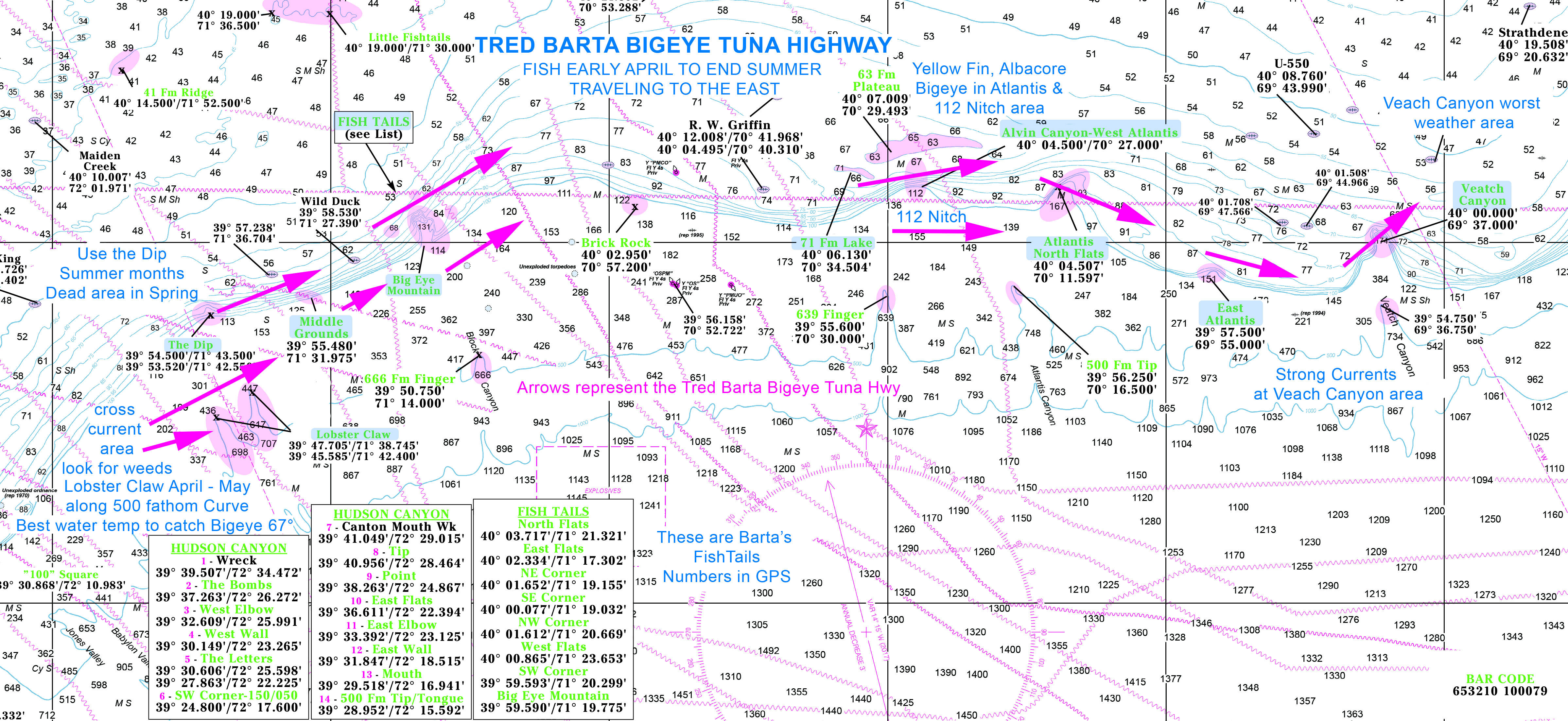
- Planning a fishing trip: Capt Segull charts show the most productive fishing area. Ease of seeing a large overview of your area. Making planning your fishing trip easier.
- Detailed Information: We provide more GPS coordinates than GPS units, more wrecks, reefs, ledges, contour lines, and local fishing areas with names. Constantly being updated with fishing locations from local fishermen.
- Bring the chart on the boat: Not catching fish in that location or you hear on the radio that fish are being caught in a different spot. Capt. Segull charts give you a quick reference guide to find that area.
- Sea Floor Composition: Each chart shows what the bottom of the sea floor is composed of, helping you understand the underwater terrain.
- Huge amount of information for a very inexpensive price.
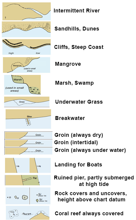
NOAA Chart Designations |
|||||||||||||
|
|||||||||||||
|

|
|||||||||||||
|
|||||||||||||
|
|
|||||||||||||
|
|||||||||||||
|
|
|||||||||||||
|
|||||||||||||
|