Captain Segull’s Coastline Layout
Scroll down for more Maps of the Coastlines of the United States.
Chart page is posted by Geographic location North to South then West.
Offshore charts in Blue color. Bathymetric in Light Blue. Inshore charts in Magenta. Small Boat/Kayak Charts in Orange.
Map of coast from Maine to New Jersey
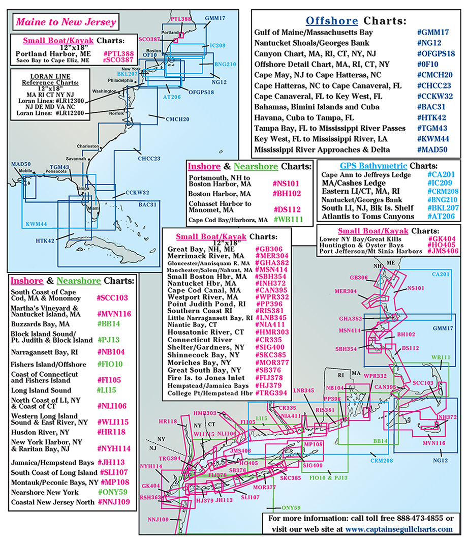
Offshore charts in Blue color. Bathymetric in Light Blue. Inshore charts in Magenta. Small Boat/Kayak Charts in Orange.
Map of coast from New Jersey to North Carolina
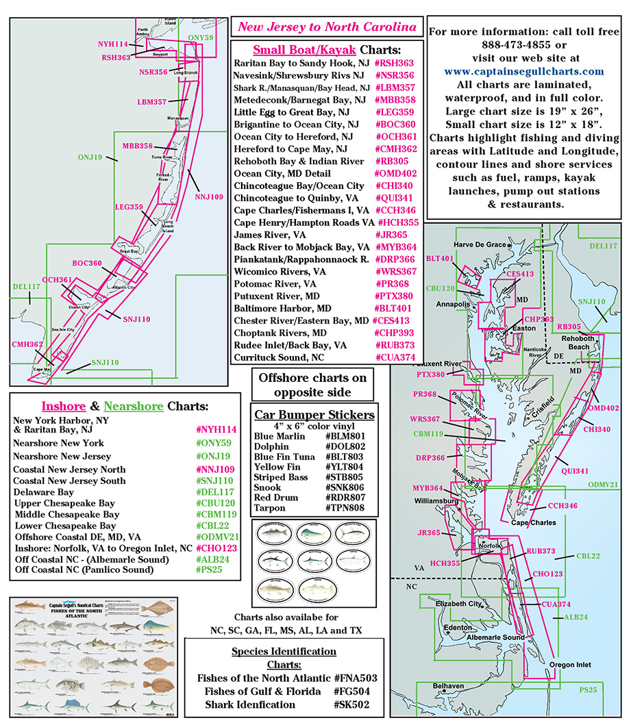
Offshore charts in Blue color. Bathymetric in Light Blue. Inshore charts in Magenta. Small Boat/Kayak Charts in Orange.
Map of coast from Virginia to South Carolina
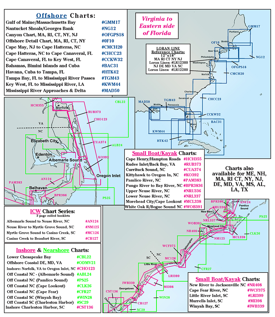
Offshore charts in Blue color. Bathymetric in Light Blue. Inshore charts in Magenta. Small Boat/Kayak Charts in Orange.
Map of coast from South Carolina to Eastern Florida
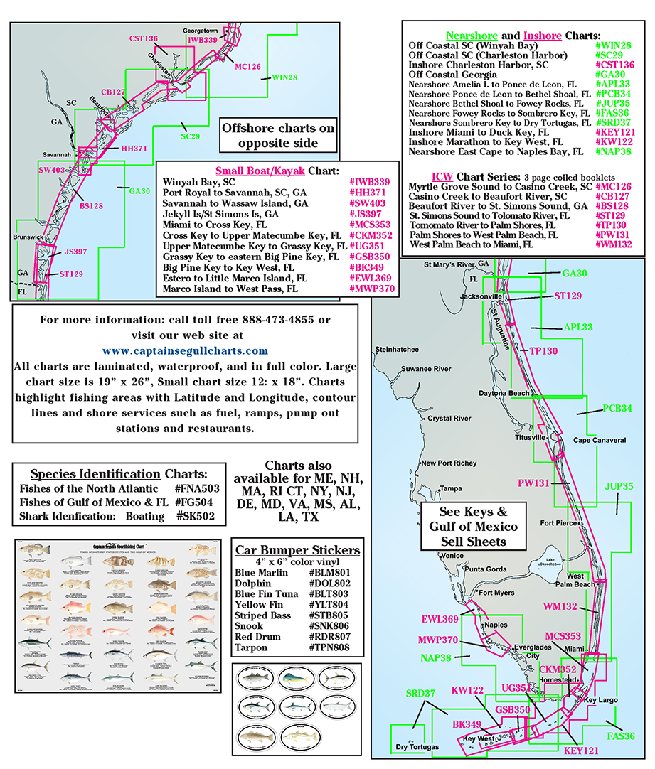
Offshore charts in Blue color. Bathymetric in Light Blue. Inshore charts in Magenta. Small Boat/Kayak Charts in Orange.
Map of coast from Florida Keys to Suwannee Florida

Offshore charts in Blue color. Bathymetric in Light Blue. Inshore charts in Magenta. Small Boat/Kayak Charts in Orange.
Map of coast from Suwannee Florida to New Orleans, LA
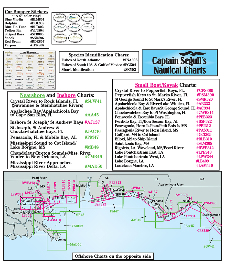
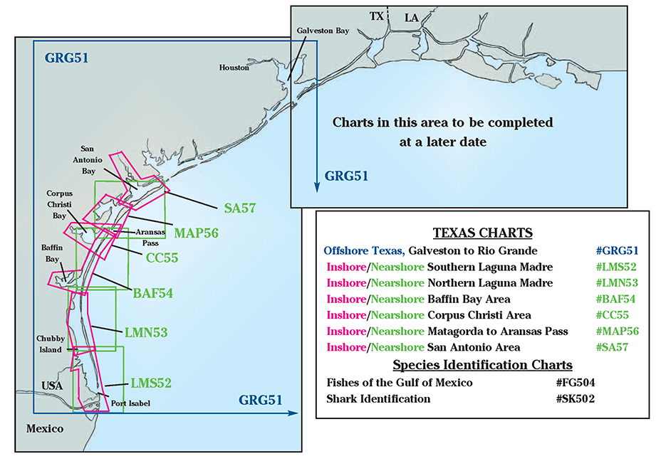
Offshore charts in Blue color. Bathymetric in Light Blue. Inshore charts in Magenta.
Map of coast of Texas from Rio Grande to Galveston